
Rujm Taba Archaeological Project (RTAP)
Benjamin Dolinka, Director
(formerly the Rujm Taba Salvage Excavations)
About one kilometer north of the northern boundary of what is locally known as the Taba
sabkha, Fritz Frank recorded a series of ruined structures, a mound of ruins partially
buried by sand dunes, and a cemetery (Frank 1934: 238). More recently, Raikes recorded the
archaeological remains in the area as that of a "Nabataean fort and village"
(Raikes, n.d.: 14-15). Subsequent visits to the area were made by David Graf and the
author during his reconnaissance in 1993 (Smith and Niemi 1994).
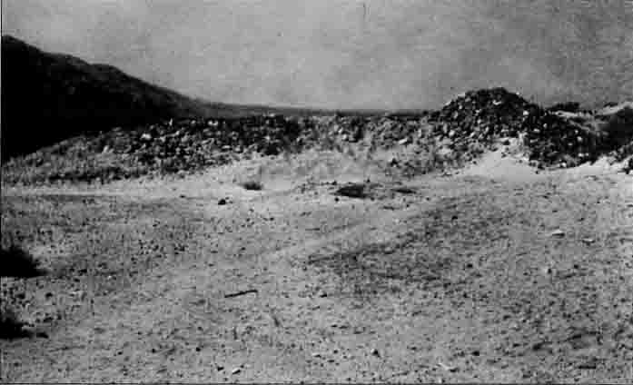 Located ca. 20 m west of the modern highway and opposite a small, incised
wadi that parallels the road, the main archaeological feature of Rujm Taba is the fortlet
or caravanserai measuring ca. 21 m square and partly buried under sand dunes encroaching
from the northwest (see fig.). Only a small section of the north wall of the fortlet
remains visible. This is two courses thick (ca. 1.3 m) and constructed of undressed
stones. It is difficult to assess whether there are rooms within the structure, although
boulders and mounds of sandy gravel can be seen. However, these may have resulted from
modification of the site by several large bulldozer cuts. The largest bulldozer cut is a
few meters east and parallel to the west wall. Debris pushed forward by the bulldozer
gives the false impression of a northwest corner tower. A light sherd scatter associated
with the structure, and similar to pottery collected at the village site discussed below,
extends to the southwest along the gravelly surface west of the wadi.
Located ca. 20 m west of the modern highway and opposite a small, incised
wadi that parallels the road, the main archaeological feature of Rujm Taba is the fortlet
or caravanserai measuring ca. 21 m square and partly buried under sand dunes encroaching
from the northwest (see fig.). Only a small section of the north wall of the fortlet
remains visible. This is two courses thick (ca. 1.3 m) and constructed of undressed
stones. It is difficult to assess whether there are rooms within the structure, although
boulders and mounds of sandy gravel can be seen. However, these may have resulted from
modification of the site by several large bulldozer cuts. The largest bulldozer cut is a
few meters east and parallel to the west wall. Debris pushed forward by the bulldozer
gives the false impression of a northwest corner tower. A light sherd scatter associated
with the structure, and similar to pottery collected at the village site discussed below,
extends to the southwest along the gravelly surface west of the wadi.
A ruined village lies east of the highway and ca. 50 m to the south of the fortlet on
the surface of a small alluvial fan. Most of the structures were destroyed during
construction of the modern highway when a large quantity of gravel was removed from the
base of the alluvial fan to line the highway bed. Further modification of the area
continues with recent bulldozing activity and local vandalism. Nevertheless, a recent
survey of the area revealed two extant structures, while several large mounds indicate
that other structures may be present. One of these structures, located at the southern
edge of the site, measures ca. 10 m square and is partitioned into four rooms of equal
size. The second structure, which lies ca. 100 m to the north, is similar in design. The
walls of both structures are two courses wide (ca. 0.50 m) and constructed of unhewn
cobbles and larger stones from the alluvial fan surface. On the steep slope of the
alluvial fan that rises above the village, a cemetery of roughly 50 tombs/burials has been
identified. A sizeable collection of pottery from Rujm Taba revealed a predominately Early
Roman/Nabataean date for the occupation of the site.
Project Summary
In May 1994, fresh bulldozer tracks were clearly visible from the highway, which
entered into the fortlet over the east wall. One could only speculate on the damage caused
by this new activity and wonder if the fort would not be obliterated in forthcoming years.
With so few Nabataean settlements existing in this part of Jordan, the importance of the
cultural information stored at Rujm Taba is magnified. As the economic development within
Wadi Araba accelerates, the threat of completely losing this information is soon becoming
a sad and impending reality.
At that time, WAARP hoped soon to begin salvage excavations at Rujm Taba in order to
preserve what remains of this important archaeological site. The project would serve to
convince local authorities that Rujm Taba may serve in the grand scheme of regional
economic development as an archaeological park for the promotion of tourism.
Fortunately, beginning in 2001, Benjamin Dolinka took on the project of invesitgating Rujm Taba. Dolinka, whose excellent work on Nabataean pottery was recently published (Dolinka 2003), has so far spent one season at the site and anticipates futures seasons. His work has appeared in various formats to date (see bibliography).
SEE NOW:
Dolinka, B.
2003 Nabataean
Aila (
2002 A Nabataean Caravanserai at Rujm Taba. Occident & Oriens 7.1: 19-21.
Dolinka, B., et al.
2002 The Rujm Taba Archaeological Project
(RTAP): Preliminary Report on the 2001 Field Season. Annual of the Department of Antiquities of
Credits - Image of Rujm Taba on the page courtesy of B. Dolinka from B. Dolinka et al. (2002).
Navigate to Additional Bibliography
copyright ©1996 Wadi Araba Archaeological Research Project
Most recent update: 7/10/07
For more information contact amsii@hotmail.com