GIS Application In order to better understand the cultural landscape of Wadi Araba in relation to the natural environment, the Wadi Araba Archaeological Research Project (WAARP) began development of a GIS application in 1998-99 to integrate data gathered by the Southeast Araba Archaeological Survey with data gathered by other projects operating in Wadi Araba, which included the WAARP's Bir Madhkur Project and the Central Araba Archaeological Survey, in addition to related projects elsewhere in Jordan and Israel. In recent years, it has become apparent that this data serves not only the Wadi Araba Archaeological Research Project, but has more practical applications for CRM in Jordan (and Israel) in light of such projects as the Red Sea - Dea Sea Canal (Pipeline) Project, the feasibility study for which is again underway. Examples of the project's GIS application are presented here for information purposes. Should you have any comments or questions, please contact the project's director, Dr. Andrew M. Smith II.
|
|
||||
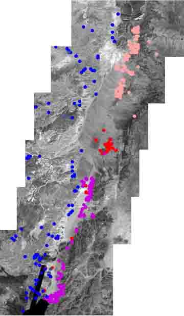 |
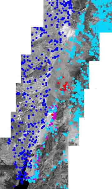
Image of Wadi Araba depicting known and upublished archaeological sites recorded by various survey projects in southern Jordan and Israel. Note that the pink dots represent those sites of the Southern Ghor and Northeast Arabah Archaeological Survey (SGNAS), the blue dots represent relevant sites in Israel, and the purple dots represent those sites of the Southeast Araba Archaeological Survey (SAAS). Importantly, notice the red dots that represent this project's ongoing research in the Central Wadi Araba. The project's goal is to connect the dots, so to speak, between the SGNAS's southern survey limit and the northern survey limit of the SAAS. | ||||
|
|
Image of Wadi Araba with important features marked out. Note that the bright aquamarine dotes represent sites recorded in the Jordan Antiquities Database Information System (JADIS). For information regarding JADIS, click here. |
||||
|
|
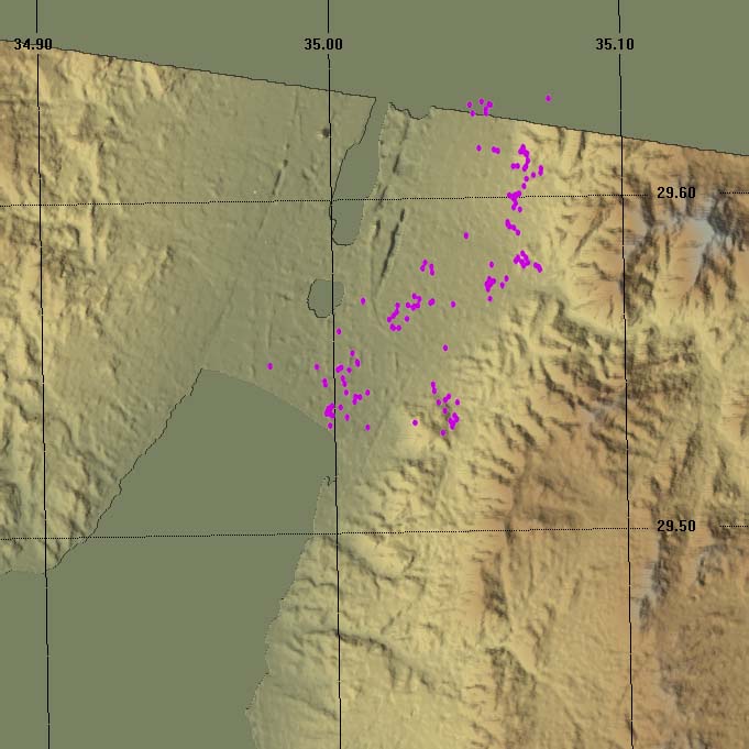
WAARP is also utlizing Digital Terrain Modelling to understand settlement patterns and to generate predictive models for determining site location and communication networks. Left is an example showing sites from the Southeast Araba Archaeological Survey plotted onto a DEM of the Aqaba region. |
||||
|
|
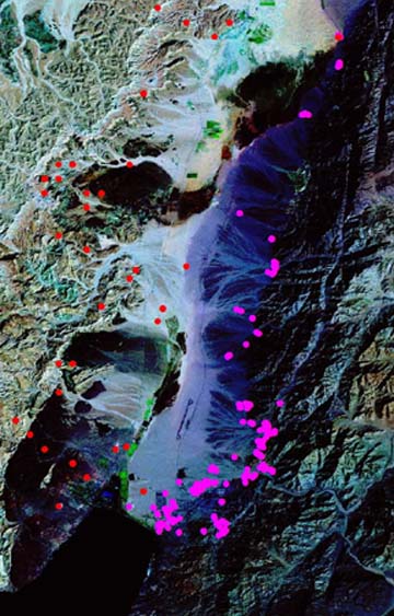
WAARP is also utilizing LANDSAT satellite imagery to support agricultural and environmental research in relation to the Araba's cultural landscape. Left is an example showing significant sites in the southern Wadi Araba. |
||||
copyright ©1996 Wadi Araba Archaeological Research Project
Most recent update: 7/10/07
For more information contact amsii@hotmail.com
![]()
 Page Remains Under Development - please check back soon